
Cameras
Dedicated Survey Cameras
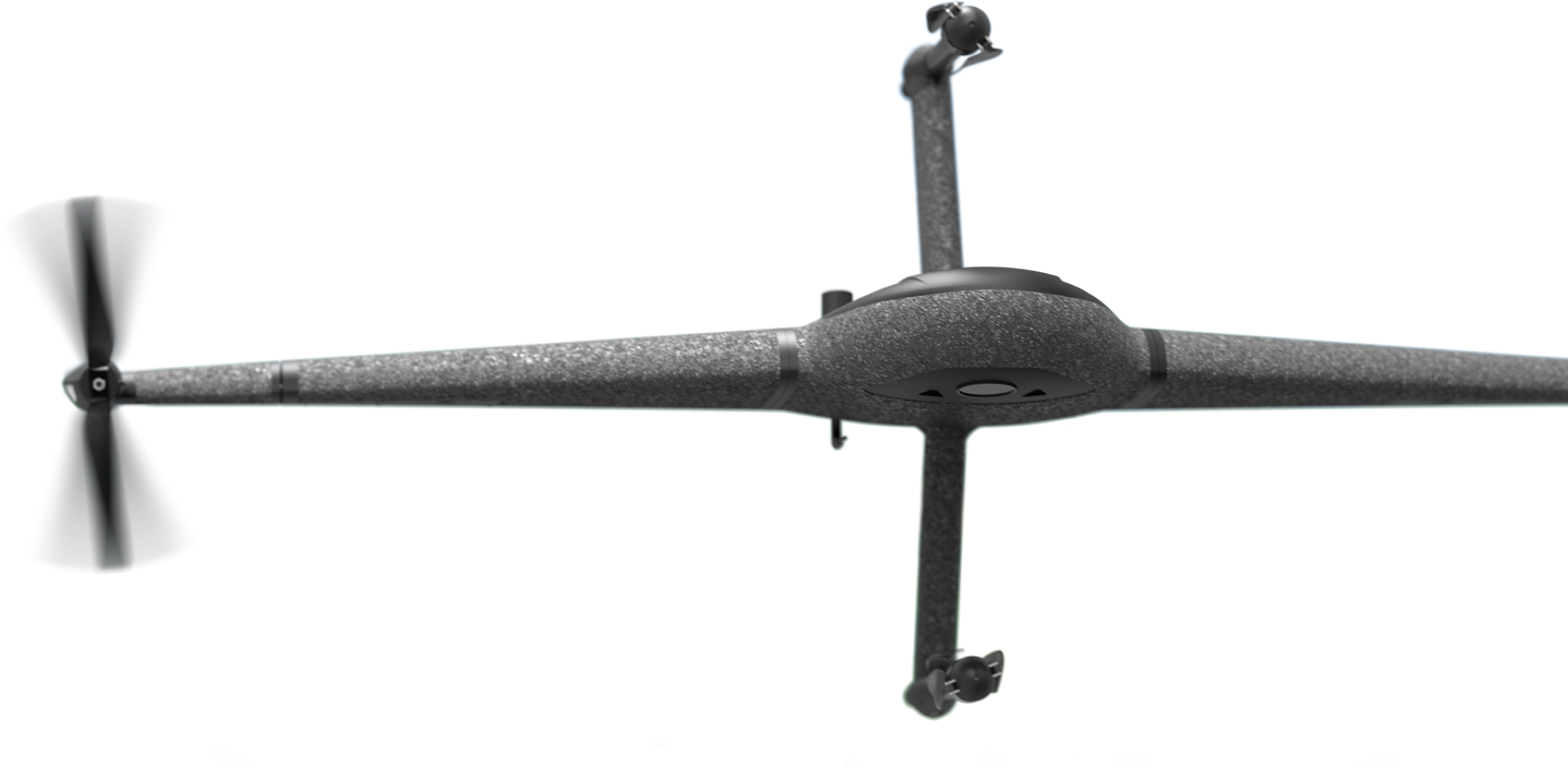
Marlyn’s cameras are modular, meaning they're swappable in minutes. A variety of RGB and specialty cameras are available to suit your project requirements.


Surveyors deserve better than 30km/h wind limits. That's why with Marlyn you can take off, survey, and land comfortably in winds of up to 45km/h (28mph), more than any other survey drone.

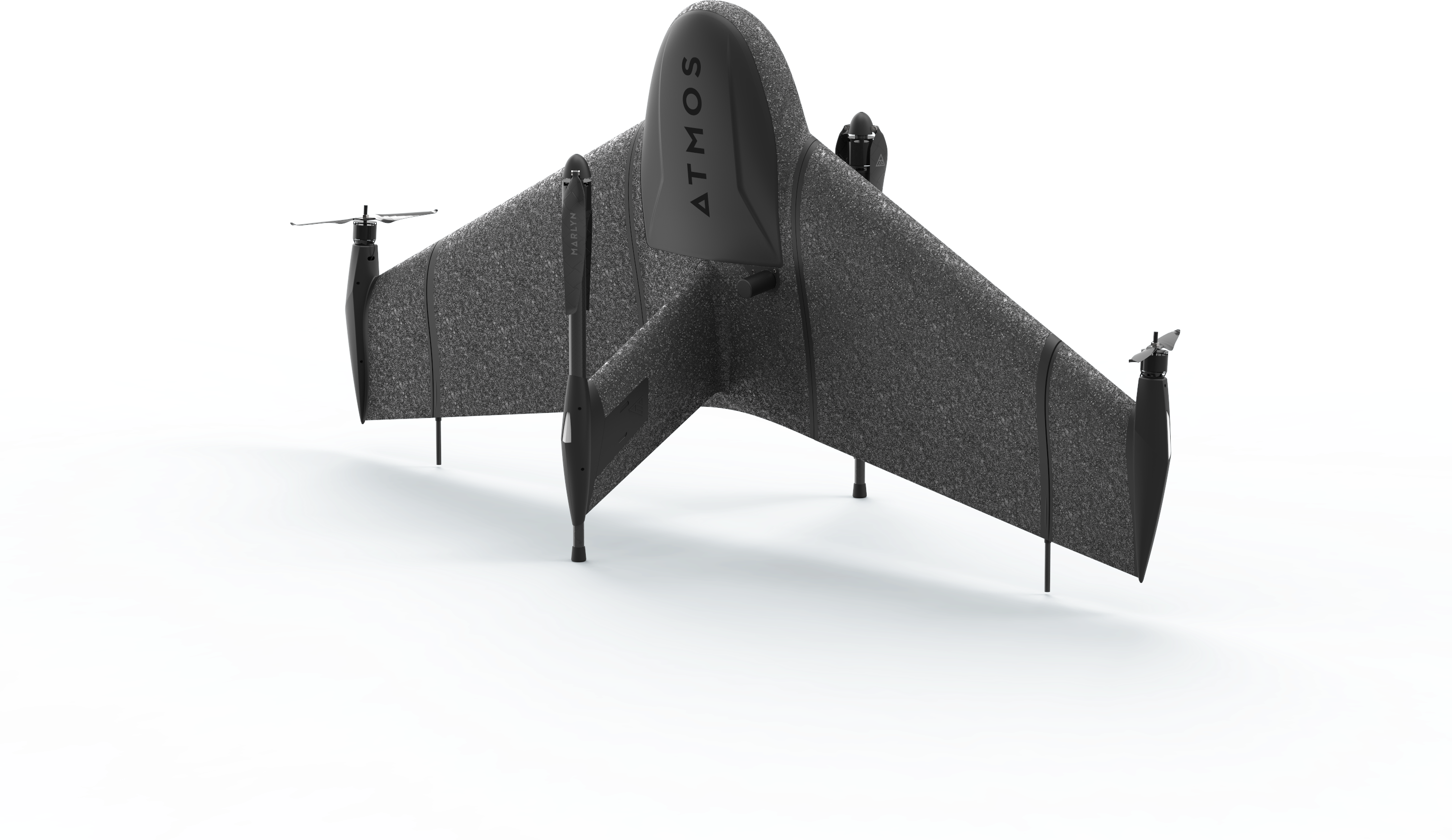
Take off like a Helicopter and Fly like an Airplane. With Marlyn you can operate from anywhere and cover up to 150Ha (370 Acres) per flight. No more finding large clear areas for belly landing!

To ensure high-end quality and ethical trade standards, we believe in keeping things local. That’s why all of our Marlyns are designed, created, and assembled right here in the Netherlands.

Take your data capture to the next level. Marlyn speeds up your data capture by surveying large areas up to 30x faster than traditional land surveying methods, and up to 10x faster than Multicopter drones.
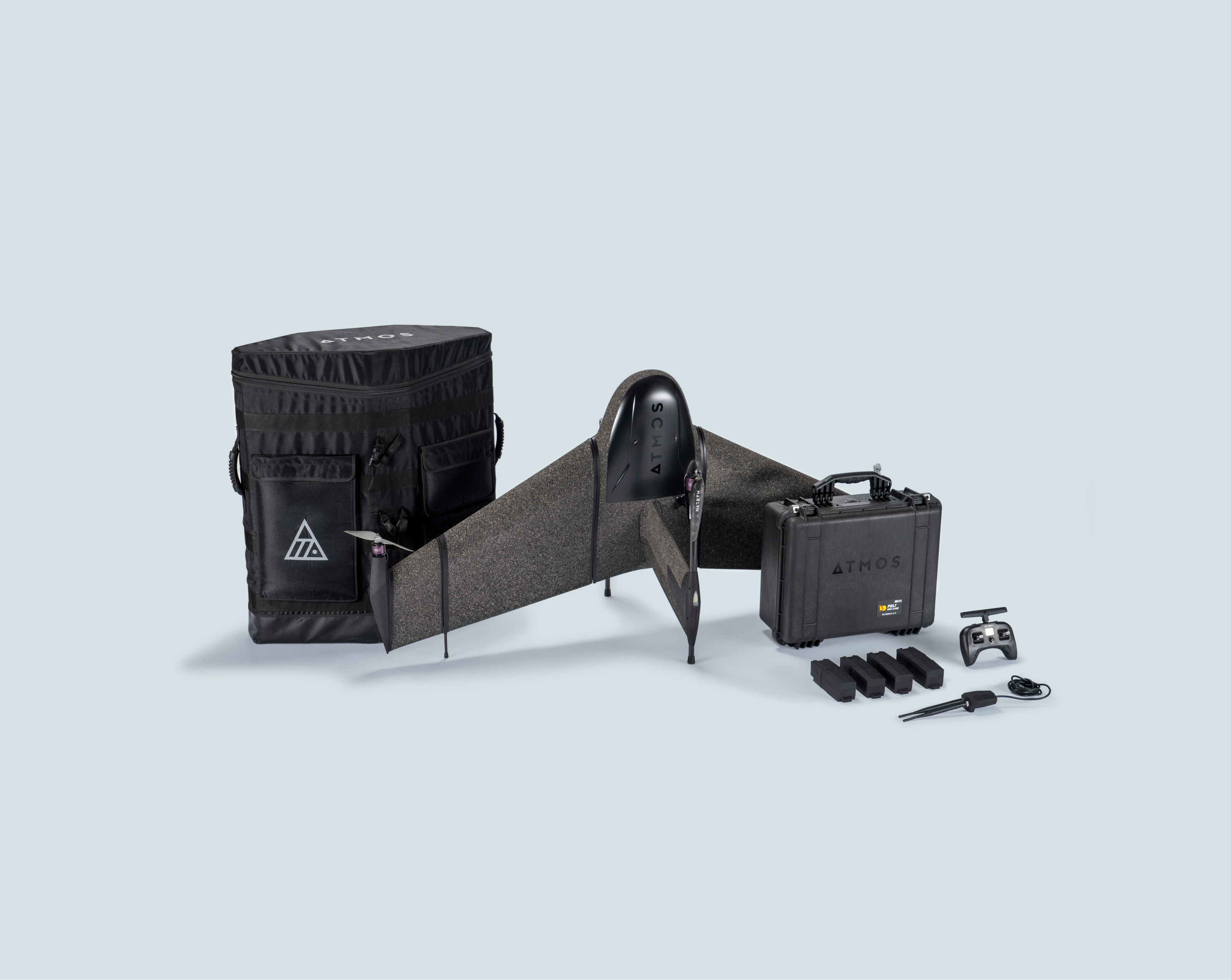
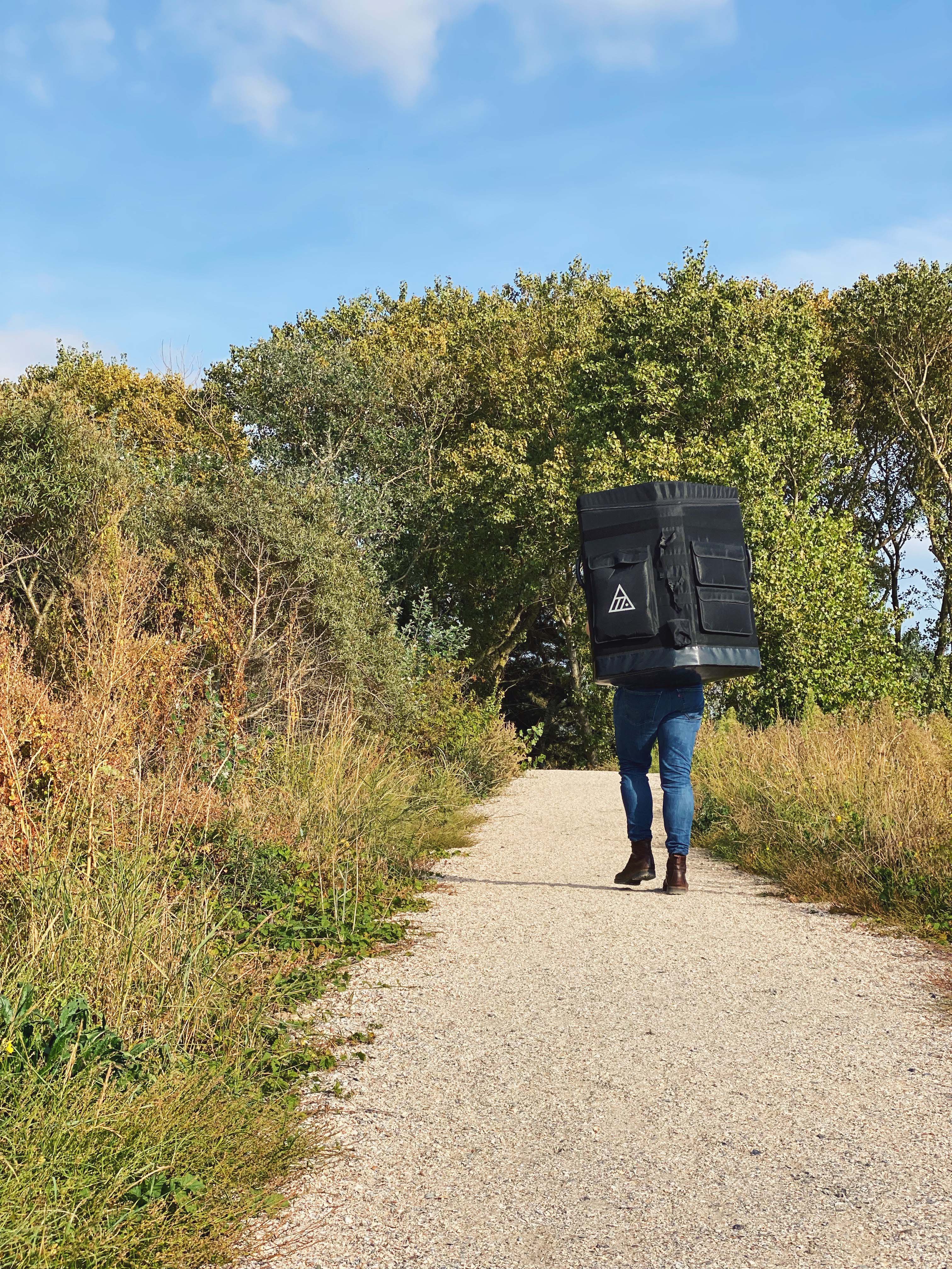
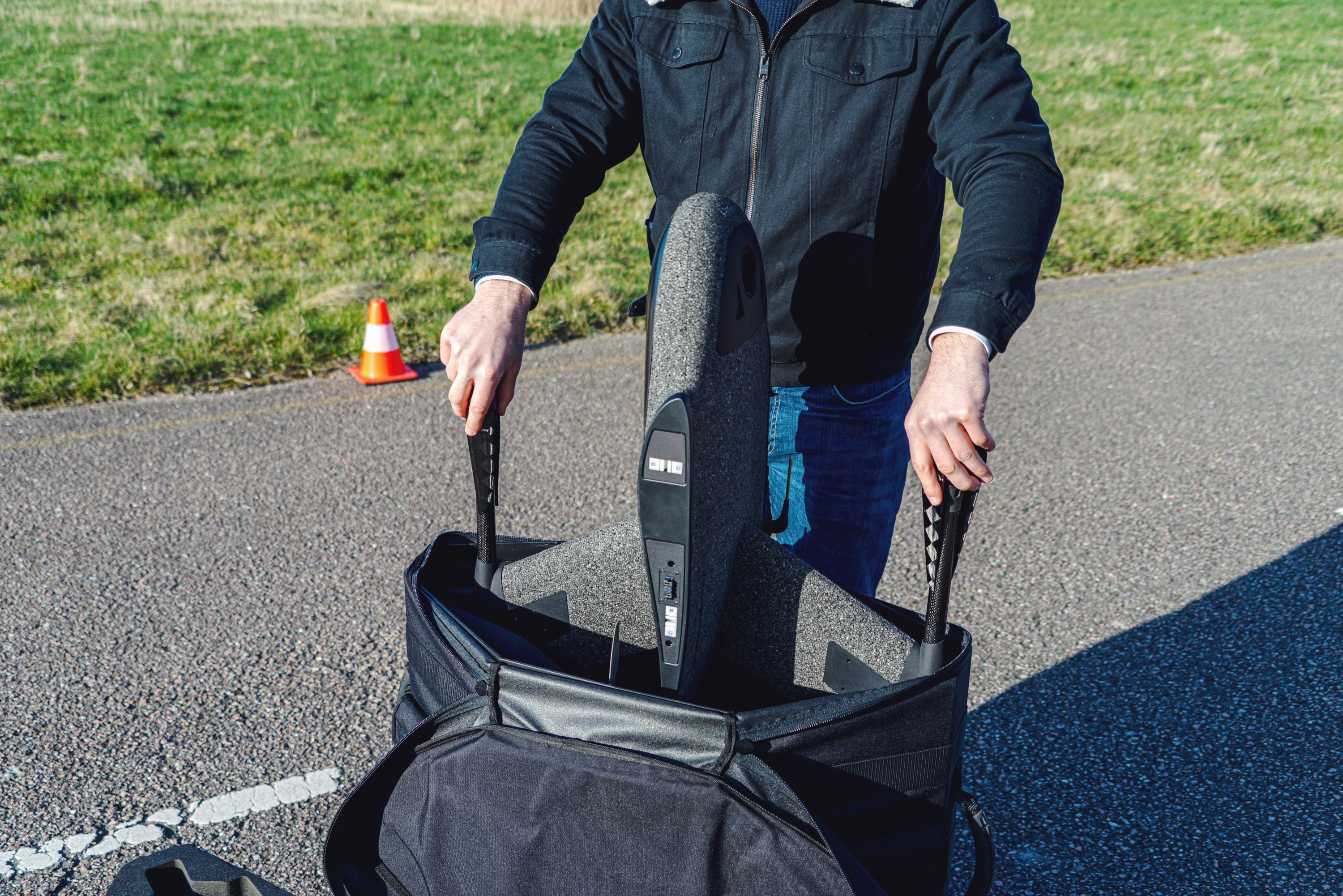
Small take-off areas? No problem, Marlyn only needs a 2x2m flat area to take off and land allowing you to be flexible in your operations. Easy backpack transport is also perfect for those heading off the beaten track.
With Marlyn 'no-go' days are turned into routine projects. You get the benefit of flying in wind conditions of up to 45km/h at ground level, and 55km/h at cruise altitude resulting in up to 30% more days per month.
Accuracy is king in the surveying world. Attain accuracies as low as 1cm with Sony’s 61MP, full-frame A7RIV combined with Topcon's PPK module, an Aerial surveying match made in heaven!

Marlyn’s cameras are modular, meaning they're swappable in minutes. A variety of RGB and specialty cameras are available to suit your project requirements.

Developed with ease of use and Data Quality in mind, your in-field operation software Navigator and geo-referencing Geotagger will allow you to get survey-quality data without all the hassle and inaccuracies typically associated with certain mapping drones.
Learn More


When you speak to Atmos you’re speaking to one of Marlyn's engineers, not some 3rd party operator. With Marlyn, the best quality of support and a quick problem resolution becomes the normal state of play.

We believe in ‘global reach with a local touch’. No matter if you find yourself in Indonesia, UK, Kuwait or Chile, we have a global reseller network on 6 continents with boots on the ground to give you the best local support.

We believe in smartly engineered no-nonsense solutions, where everything is focussed on giving the modern surveyor the tools they need to get the highest possible accuracy and quality. Don't settle for second best!
.jpg)
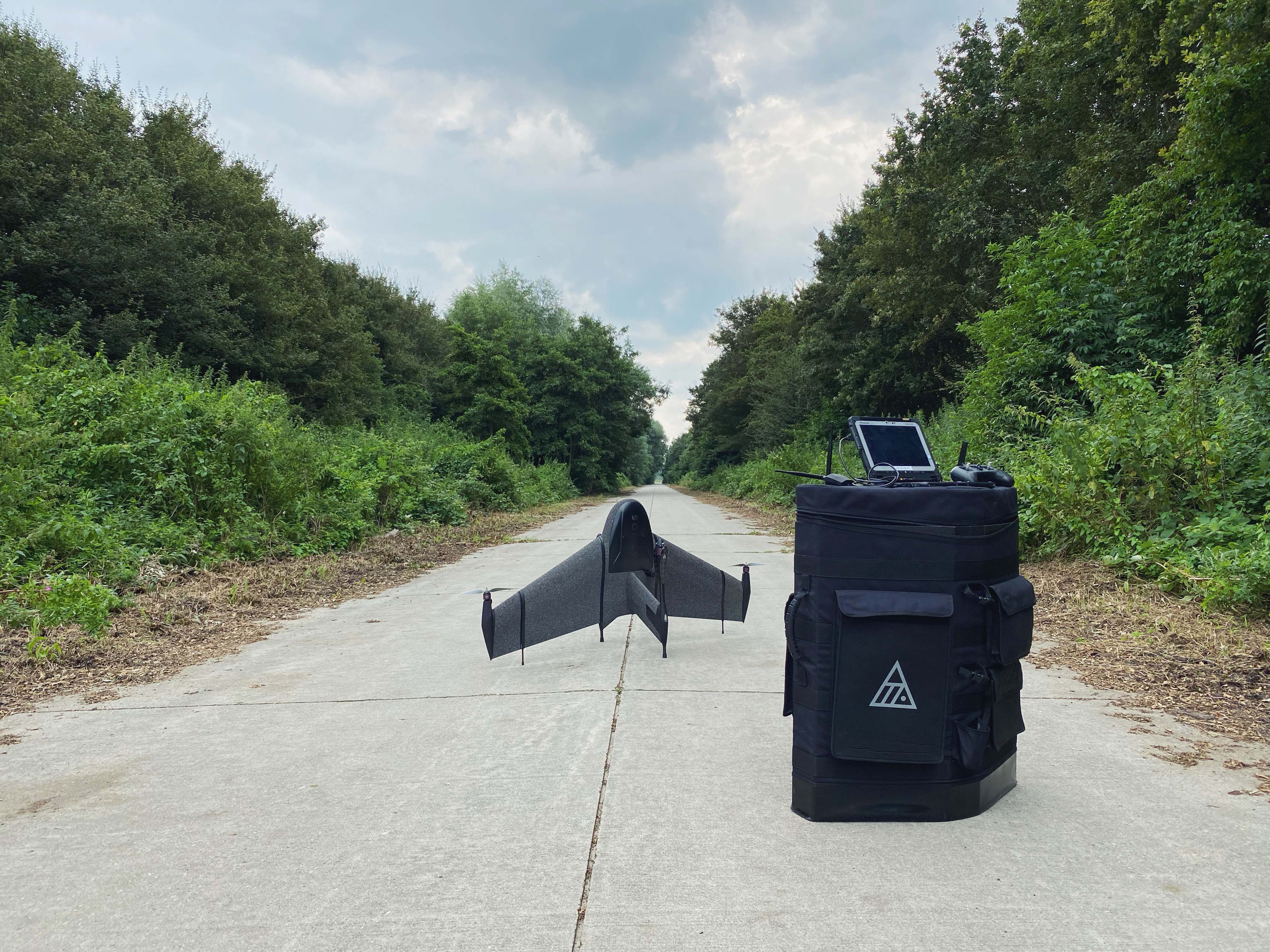
2 x 2 m [7 x 7 ft ] required
5 minutes
Yes
Automatic
Automatic (configurable)
65 km/h [40 mph]
Take off: 45 km/h [28 mph] /
Cruise: 55 km/h [34 mph] /
Landing: 45 km/h [28 mph]
50 mins*
Integrated intelligent checklist in Atmos Navigator
-10°C to +40°C [14°F to 104°F] (Above 35°C operating restrictions apply)
Not required with optional PPK module


